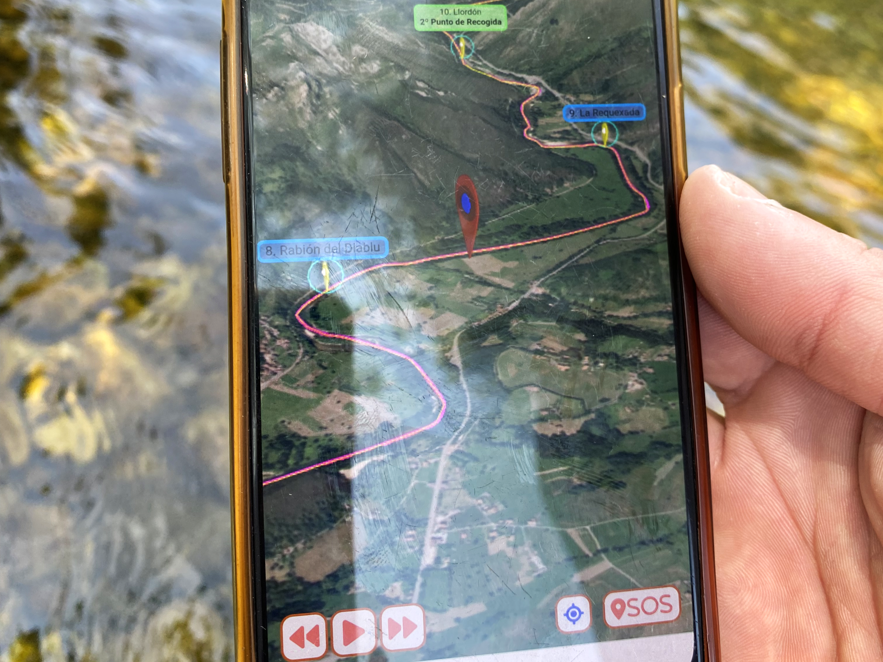
Can you imagine exploring every corner of the Sella River Descent from your mobile? At Cangas Aventura, it’s now possible thanks to our new and detailed 3D interactive map. An innovative resource that will allow you to know in detail one of the most exciting canoe routes in Asturias, improving your experience and safety on the route.
We show you how to make the most of this map with the complete route in our latest YouTube short. Don’t miss it!
Know the route in detail
Accessing the Sella River Descent has never been easier! Explore the public map of the route on our website and visualize every curve of the river, from the starting point to the arrival at the Llovio bridge. The view in 3D will allow you to visualize each section of the route before launching into the river and thus maximize your adventure, regardless of whether it’s your first time or if you’re already an expert in the activity.
Additionally, for our customers, we offer a private map that provides an even more detailed view of the route. This interactive map includes exclusive information such as the marking of danger points throughout the route or the location of the famous Sella beach bars, where you can stop to rest and enjoy the atmosphere by the river. This information will allow you to be fully prepared to make the most of the Sella River Descent!
Enjoy without worries
What better way to enjoy the Sella River Descent in Asturias than knowing that you now have more safety than ever at your fingertips? The private map includes an SOS button that, in case of emergency, will provide your exact coordinates and a contact number for quick assistance.
Everything you might need, just a click away!
In addition, real-time GPS positioning will allow you to track your location throughout the journey, facilitating orientation and locating key points of the route.
Find points of interest with ease
The Sella River Descent is full of iconic points you won’t want to miss. With our interactive map, you can easily identify and locate all the highlighted places. Both in the public and private maps, simply click on the markers to access 360º photographs of the most important locations and get to know every corner of the river in detail.
And if you feel like making a stop at one of the beach bars along the route, the private map will allow you to easily locate all the rest points, view images and better plan your day. Additionally, it will allow you to learn other exclusive details, such as the location or appearance of the most challenging areas of the Sella River.
Experience the Sella like never before
Thanks to the combination of technology and adventure, our 3D interactive map of the Sella River Descent offers you a new way to live the experience.
You’ll be able to immerse yourself in the descent even before getting into the canoe, plan your route from start to finish, and enjoy every detail with more precision and greater safety. Regardless of your experience level, this tool will completely revolutionize the way you enjoy the best outdoor activity in Asturias.
Discover more on our YouTube channel and get ready to experience the Sella River Descent like never before. We’re waiting for you at Cangas Aventura!

